Hiking
Waterrock Knob Trail
- Difficulty
- Moderate
- Distance
- 1.2 ml
- Duration
- 1 hr
- Ascent
- 412 ft
- Descent
- 412 ft
Blue Ridge Parkway Milepost 451.2, Maggie Valley, NC 28751
Best Time of Year: Mar 01 - Oct 31
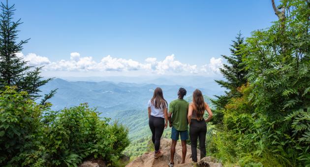
A steep 1.2-mile round trip hike to the 6292-foot summit, with several vantage points offering views up to 50 miles.
Directions to Location
- From downtown Sylva, turn left on Grindstaff Cove Road and follow it past the Justice Center to its intersection with US 23 North/US 74 East
- Travel approximately 11 miles to the Blue Ridge Parkway entrance at Balsam Gap
- Travel south toward Cherokee for 8.6 miles to Waterrock Knob (milepost 451.2).
Trails and Waterfalls can be dangerous; take no chances, only photos for memories. Read our Safety and Insider tips to have a safe, fun and enjoyable trip to Jackson County.
Leave No Trace — Seven Principles
1. Plan Ahead and Prepare
2. Travel and Camp on Durable Surfaces
3. Dispose of Waste Properly
4. Leave What You Find
5. Minimize Campfire Impacts
6. Respect Wildlife
7. Be Considerate of Other Visitors
For more details, visit www.lnt.org
©1999 by the Leave No Trace Center for Outdoor Ethics
Summit ViewsLong-Distance Views