
Dillsboro
Find the best places to grab a bite, shop for artisanal goods, and spend the night in the historic town of Dillsboro.
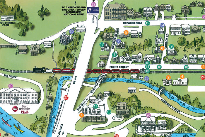
Waterfall and Hiking
Get outside and play with hikes that lead to breathtaking vistas, waterfalls that plunge into swimming holes, and horseback riding trails.
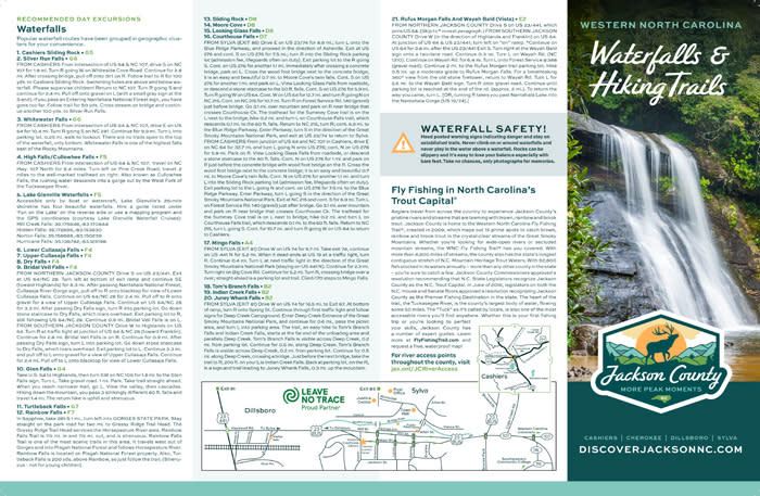
Fly Fishing Trail®
Some of the best fly fishing in North Carolina takes place in these 15 top spots for catching brook, brown, and rainbow trout.
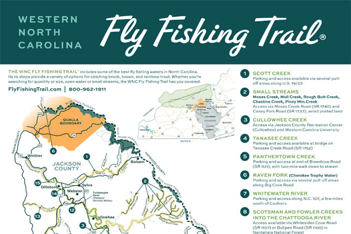
Cashiers Attractions, Adventures, & Waterfalls
Whether you’re looking to a catch a glimpse of Shadow of the Bear, tour historic sites, or find the perfect waterfall hike, Cashiers is your spot.
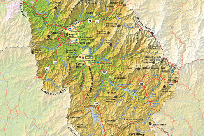
Jackson County
This relief map of Jackson County shows the communities, notable peaks, and features.
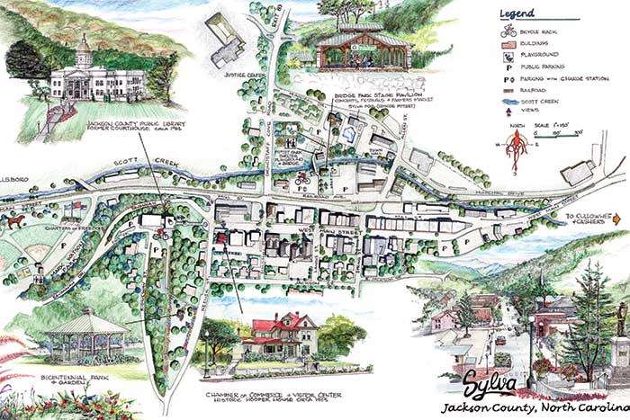
Sylva
From the Bicentennial Park & Garden to hopping breweries and plenty in between, discover why Sylva is the place where past meets present.
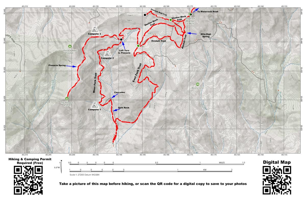
Pinnacle Park Trail Map
The 1,529-acre town park features streams, waterfalls and panoramic views throughout. The 3.4-mile trail to the top follows an old logging road for most of its length, through a grassy ridge and then up a short rocky trail to the Pinnacle where panoramic views of Sylva and Scotts Creek Valley await.
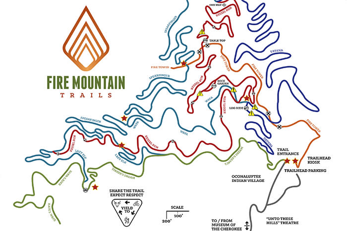
Fire Mountain Trails
The Fire Mountain Trails are an unparalleled mountain bike trail system of 10.5 miles of beginner-to-advanced routes located near the Oconaluftee Indian Village in Cherokee. They’re only a 20-minute drive from Downtown Sylva.
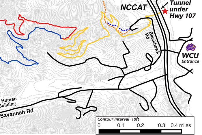
WCU Mountain Bike Trails
The WCU Multi-Use Trail system is 6.8 miles of narrow single-track trail designed for foot traffic and mountain bike use. The trail is intermediate in difficulty with steep mountainside terrain. Although the elevation change from the trail’s highest to lowest point is just a few hundred feet, there are lots of ups and downs for bikers to enjoy.
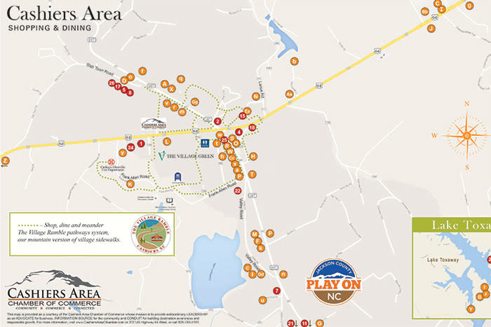
Cashiers Shopping & Dining Guide
Hold on to your wallets because Cashiers is packed with fine dining restaurants, culinary hot spots, and local pubs, as well as antique shops, high-end boutiques, and artsy galleries.
Tuckasegee River
Flowing almost the entire length of Jackson County, “The Tuck” offers opportunities to fish, tube, canoe, kayak, and even whitewater raft. This map available online only.
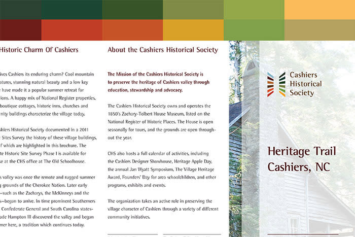
Cashiers Historical Society Heritage Trail
Discover 29 historic homes, inns, churches, schools, businesses, gardens, and government buildings spread throughout charming Cashiers.
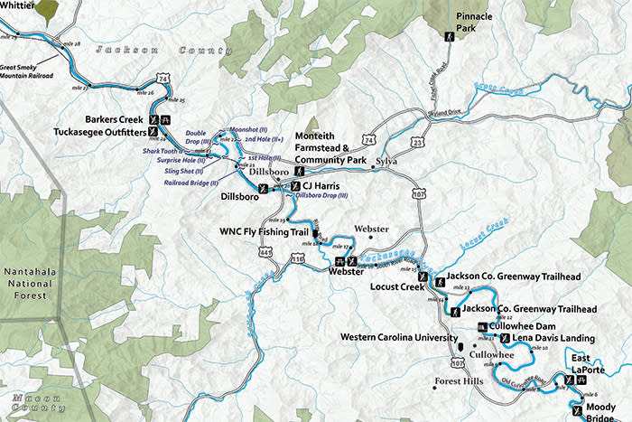
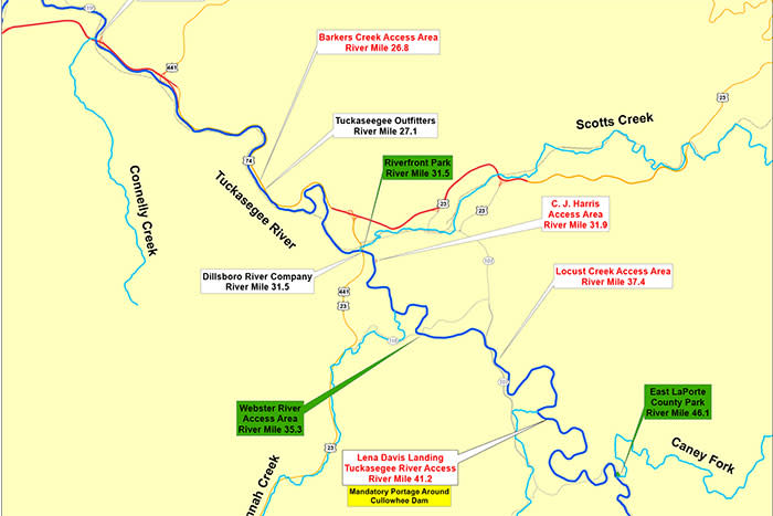
Tuckasegee River Blue Trail Map
This map of the Tuckasegee River by American Whitewater shares several points of interest along the Tuck along with suggested activities.
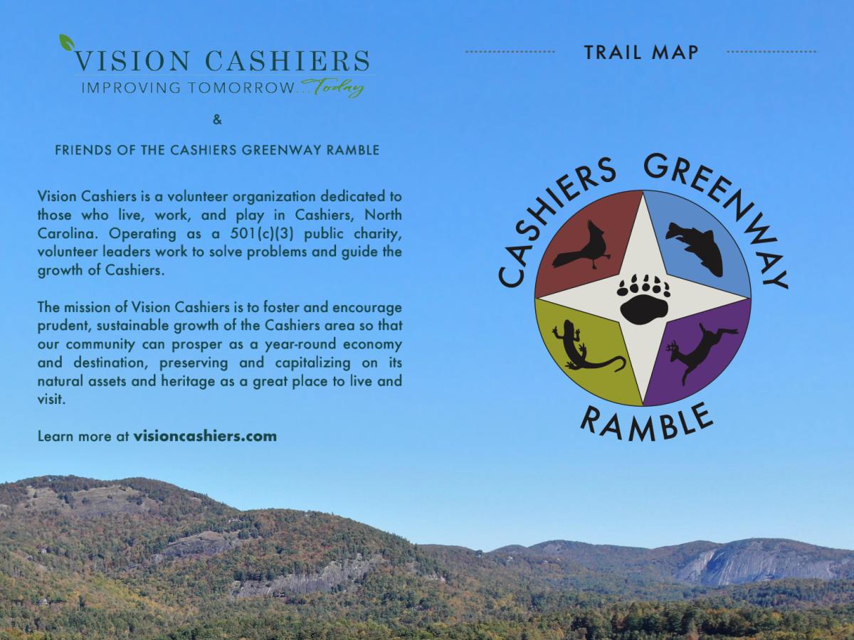
Cashiers Greenway Ramble
Enjoy the heart of Cashiers on the Cashiers Greenway Ramble – an extensive network of trails, sidewalks, and pedestrian-friendly roads.

Sylva's Story - A Walking Tour
Stroll historic Main Street with this self-guided walking tour tracing Sylva's story — from its Cherokee origins and the railroad that built the town to its famous courthouse, Depression-era banks, and golden-age movie theaters.
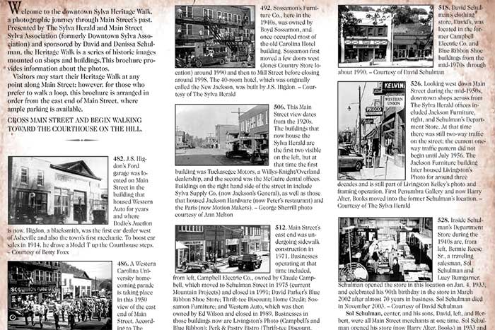
Sylva Heritage Walk
A photographic journey through the past of Sylva’s Main Street, the Heritage Walk features a series of historic images on shops and buildings.
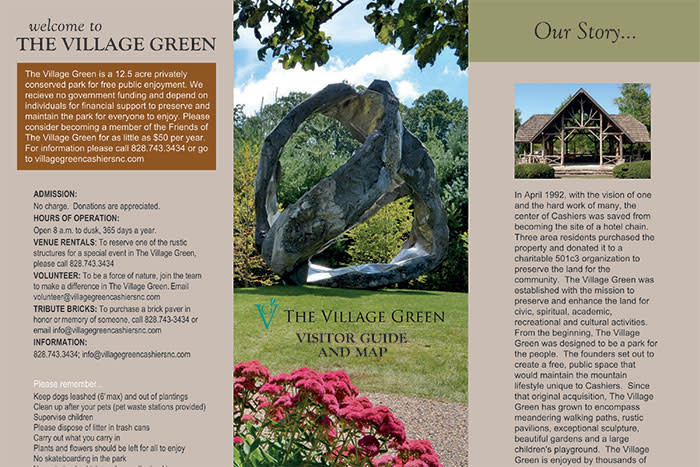
The Village Green Visitor Guide
A 12.5-acre park in the heart of downtown Cashiers, The Village Green features eight art sculptures, an expansive play space, gardens, and a wetland trail walk.
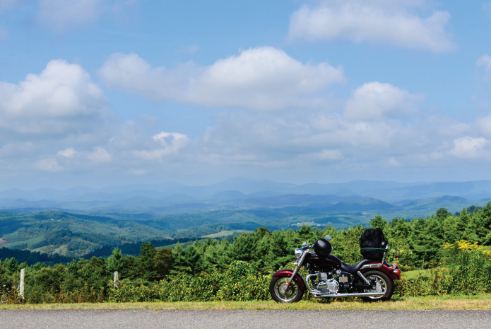
Motorcycle Guide/Map
The guide is “geared” toward the avid motorcyclist. From one rider to another, these are the routes our locals love best. Hop on and head to your next adventure in the western North Carolina mountains!
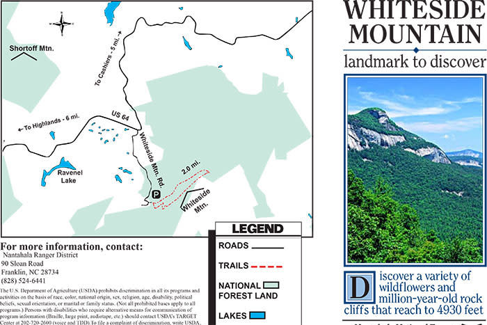
Whiteside Mountain
This striking natural landmark features a two-mile loop trail, outstanding views, a variety of wildflowers, and rock cliffs reaching 4930 feet.
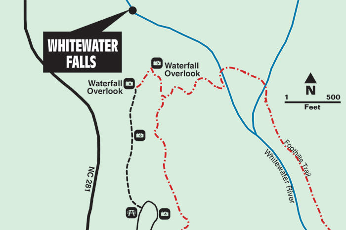
Whitewater Falls
The East’s king of waterfalls, Whitewater Falls cascades over massive rock pillars and drops 411 feet to the river below.


