Hiking
Richland Balsam Trail
- Difficulty
- Easy
- Distance
- 1.5 ml
- Duration
- 1 hr
- Ascent
- 700 ft
- Descent
- 700 ft
Blue Ridge Parkway Milepost 431, Canton, NC 28716
Best Time of Year: Mar 01 - Oct 31
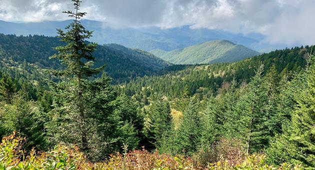
A 1.5-mile loop trail through a spruce-fir forest, climbing about 700 feet to the highest peak on the Blue Ridge Parkway.
Directions to Location
- From downtown Sylva, turn left on Grindstaff Cove Road and follow it past the Justice Center to its intersection with US 23 North/US 74 East
- Travel approximately 11 miles to the Blue Ridge Parkway entrance at Balsam Gap
- Travel north toward Asheville to milepost 431, then turn left into the Haywood-Jackson overlook parking lot
- The trail begins at the left corner of parking lot and is paved at its start.
Trails and Waterfalls can be dangerous; take no chances, only photos for memories. Read our Safety and Insider tips to have a safe, fun and enjoyable trip to Jackson County.
Leave No Trace — Seven Principles
1. Plan Ahead and Prepare
2. Travel and Camp on Durable Surfaces
3. Dispose of Waste Properly
4. Leave What You Find
5. Minimize Campfire Impacts
6. Respect Wildlife
7. Be Considerate of Other Visitors
For more details, visit www.lnt.org
©1999 by the Leave No Trace Center for Outdoor Ethics
Spruce-fir ForestHigh Peak Views