Hiking
Panthertown Valley Trail
- Difficulty
- Moderate
Cold Mountain Gap Trailhead, Cold Mountain Rd, Lake Toxaway, NC 28747
Best Time of Year: Mar 01 - Nov 30
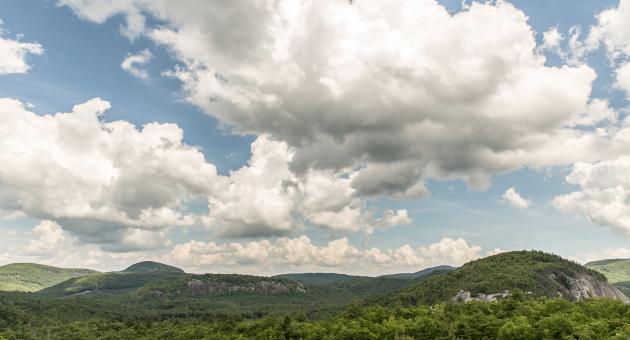
Known as the 'Yosemite of the East,' this trail offers scenic riverside hikes and waterfall views within 6311 acres of rugged backcountry land.
Directions to Location:
Salt Rock Gap Trailhead
- From the NC 107/US 64 junction in Cashiers, take US 64 east for 2 miles to Cedar Creek Road (SR 1120), on left.
- Take Cedar Creek Road 2.3 miles to Breedlove Road (SR 1121), turn right.
- Take Breedlove Road 3.5 miles to trailhead parking area. Paved road becomes gravel the last 0.2 miles. (From Glenville, on NC 107, take Bee Tree Road (SR 1124) 0.4 miles to Cedar Creek Road (SR 1120), on right, then take Cedar Creek Road 3.1 miles to Breedlove Road, on left.
Cold Mountain Gap Trailhead
- From Brevard, take US 64 west for 16 miles to Blue Ridge Road (NC 281).
- Turn right.
- Go 0.8 miles to Cold Mountain Road (SR 1301).
- Turn left.
- Go 5.8 miles to the end and turn left onto Panthertown Road.
- Go 0.1 mile on gravel to parking lot entrance, on right.
- From Cashiers, take US 64 east for 13 miles to where Blue Ridge Road, NC 281, turns left at Toxaway.
Flat Creek Road Trailhead
- From the NC 281/US 64 junction at Lake Toxaway, take NC 281 north for 9.1 miles to Rock Bridge Road (SR 1140), on left.
- Take Rock Bridge Road for 3.0 miles to the parking area, on right.
- This is the only parking for Panthertown Valley suitable for horse trailers.
- (From Tuckaseegee, on NC 107, take NC 281 south for 15.9 miles to Rock Bridge Road, on right.)
Trails and Waterfalls can be dangerous; take no chances, only photos for memories. Read our Safety and Insider tips to have a safe, fun and enjoyable trip to Jackson County.
Leave No Trace — Seven Principles
1. Plan Ahead and Prepare
2. Travel and Camp on Durable Surfaces
3. Dispose of Waste Properly
4. Leave What You Find
5. Minimize Campfire Impacts
6. Respect Wildlife
7. Be Considerate of Other Visitors
For more details, visit www.lnt.org
©1999 by the Leave No Trace Center for Outdoor Ethics
RiverWaterfallsScenic Backcountry